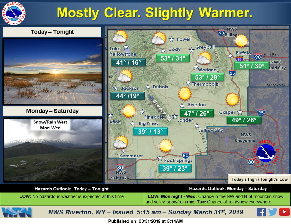

Mostly clear and slightly warmer conditions today and for the early part of the work week. The next system will impact the west on Monday night with a chance of snow and rain, before spreading east of the Divide Tuesday.
Detailed Forecast
Today
Sunny, with a high near 40. West southwest wind 5 to 10 mph becoming north northwest in the afternoon.
Tonight
Partly cloudy, with a low around 22. West southwest wind 8 to 10 mph.
Monday
Partly sunny, with a high near 45. West wind 7 to 11 mph.
Monday Night
A 40 percent chance of snow after midnight. Mostly cloudy, with a low around 28. West wind 5 to 10 mph becoming light and variable. New snow accumulation of less than a half inch possible.
Tuesday
A chance of snow before 11am, then rain and snow likely. Cloudy, with a high near 41. South wind 6 to 8 mph. Chance of precipitation is 60%. New snow accumulation of less than a half inch possible.
Tuesday Night
A chance of rain and snow before 2am, then a chance of snow. Cloudy, with a low around 29. South wind 5 to 8 mph becoming north northeast after midnight. Chance of precipitation is 50%.
Wednesday
A chance of snow showers before 11am, then a chance of rain and snow showers between 11am and 1pm, then a slight chance of rain showers after 1pm. Mostly cloudy, with a high near 45. North northwest wind 6 to 14 mph becoming west in the afternoon. Winds could gust as high as 24 mph. Chance of precipitation is 30%.
Wednesday Night
Mostly cloudy, with a low around 29.
Thursday
Mostly sunny, with a high near 49.
Thursday Night
Mostly cloudy, with a low around 31.
Friday
Mostly cloudy, with a high near 52.
Friday Night
Mostly cloudy, with a low around 32.
Saturday
A slight chance of showers. Partly sunny, with a high near 52.