
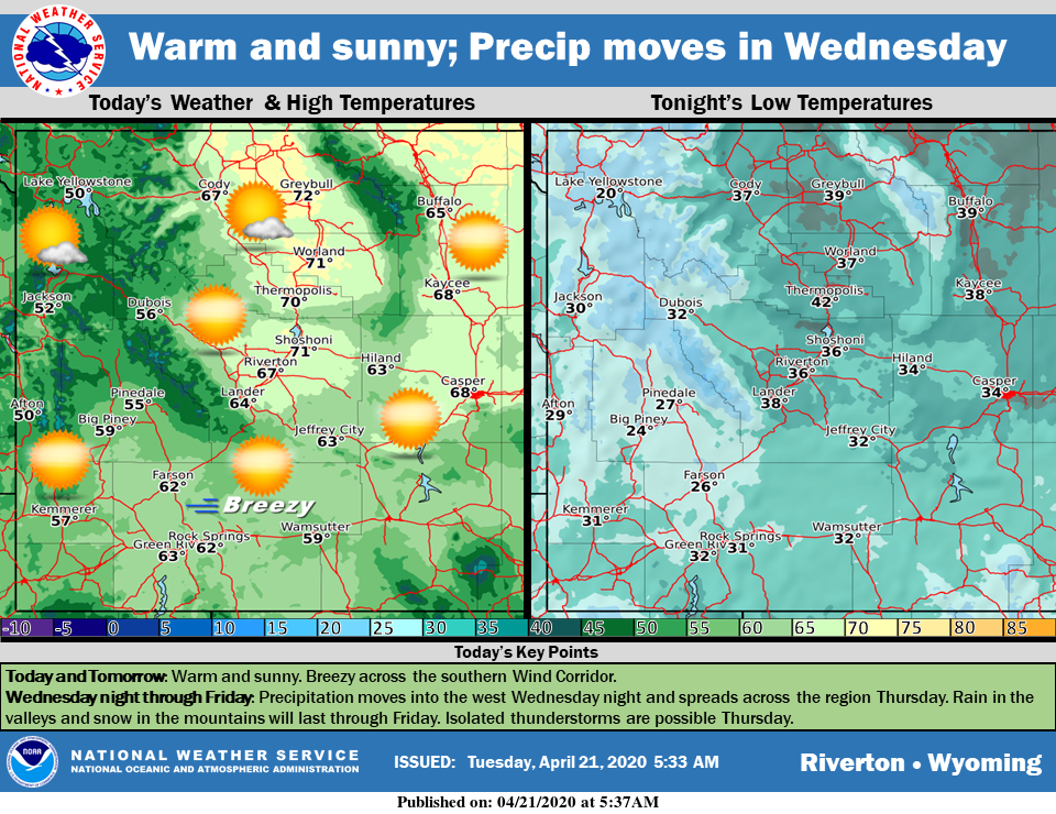
Weather Story
Warm and sunny today and tomorrow with breezy conditions across the southern Wind Corridor both days. Wednesday night, precipitation begins to move into the west and spreads across central and eastern areas Thursday. A few isolated rumbles of thunder are possible Thursday afternoon. Expect rain in the valleys and snow in higher elevations. Precipitation will last through Friday.
– Detailed Forecast –
Today
Sunny, with a high near 62. Breezy, with a light west northwest wind increasing to 10 to 15 mph in the morning. Winds could gust as high as 24 mph.
Tonight
Mostly clear, with a low around 31. Blustery, with a west northwest wind 9 to 15 mph, with gusts as high as 23 mph.
Wednesday
Sunny, with a high near 61. Windy, with a west wind 11 to 16 mph increasing to 20 to 25 mph in the afternoon. Winds could gust as high as 37 mph.
Wednesday Night
Mostly cloudy, with a low around 38. Breezy, with a west wind 11 to 20 mph, with gusts as high as 28 mph.
Thursday
A 40 percent chance of rain, mainly after noon. Partly sunny, with a high near 56. Breezy, with a west wind 14 to 24 mph, with gusts as high as 37 mph.
Thursday Night
Mostly cloudy, with a low around 32. Breezy, with a west wind 15 to 20 mph, with gusts as high as 28 mph.
Friday
A 30 percent chance of rain after noon. Mostly sunny, with a high near 53. Breezy, with a west wind 11 to 15 mph, with gusts as high as 23 mph.
Friday Night
Partly cloudy, with a low around 30. Blustery.
Saturday
Sunny, with a high near 59.
Saturday Night
Partly cloudy, with a low around 36.
Sunday
Partly sunny, with a high near 66.
Saturday Night
Mostly cloudy, with a low around 37. Breezy.
Monday
Mostly sunny, with a high near 64. Breezy.
Whatever the weather, have a wonderful day!
From all of us here at SweetwaterNOW

