
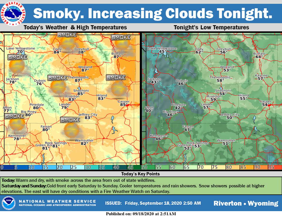
Weather Story
It will be smoky again today across the Cowboy State. An approaching front will bring cooler temperatures and increased winds. Rain and possibly snow showers will move into the west early Saturday and spread through the day.
– Detailed Forecast –
Today
Widespread haze after 10am. Areas of smoke before 10am. Sunny, with a high near 80. Light and variable wind becoming west southwest 5 to 10 mph in the afternoon. Winds could gust as high as 20 mph.
Tonight
Mostly cloudy, with a low around 53. West southwest wind 5 to 14 mph becoming south southeast in the evening.
Saturday
Scattered showers, with thunderstorms also possible after 3pm. Partly sunny, with a high near 73. Windy, with a south wind 7 to 12 mph becoming southwest 20 to 25 mph. Winds could gust as high as 31 mph. Chance of precipitation is 50%.
Saturday Night
A 20 percent chance of showers before midnight. Mostly cloudy, then gradually becoming clear, with a low around 40. West wind 6 to 14 mph, with gusts as high as 26 mph.
Sunday
Sunny, with a high near 70. Breezy, with a west wind 7 to 16 mph, with gusts as high as 26 mph.
Sunday Night
Clear, with a low around 43. Breezy, with a west wind 5 to 15 mph becoming south after midnight. Winds could gust as high as 25 mph.
Monday
Sunny, with a high near 76. South southeast wind 7 to 9 mph becoming west southwest in the afternoon. Winds could gust as high as 22 mph.
Monday Night
Mostly cloudy, with a low around 48.
Tuesday
A 20 percent chance of showers and thunderstorms after noon. Mostly sunny, with a high near 74.
Tuesday Night
Mostly cloudy, with a low around 44.
Wednesday
Sunny, with a high near 72.
Wednesday Night
Mostly clear, with a low around 42.
Thursday
Sunny, with a high near 74.
Whatever the weather, have a wonderful day!
From all of us here at SweetwaterNOW

