
Weather Story
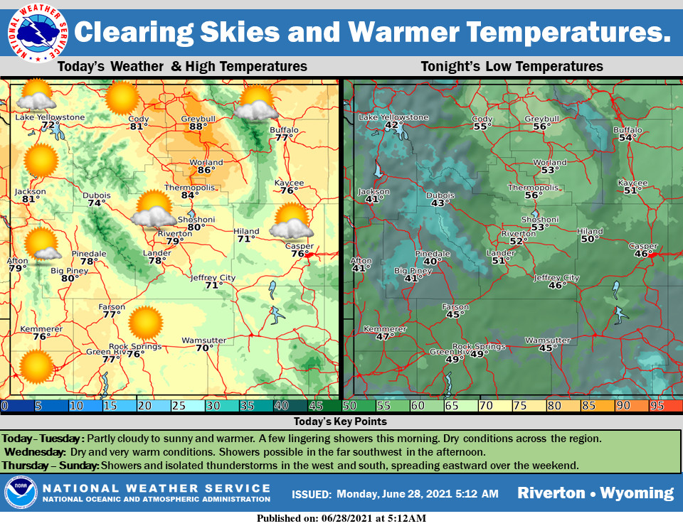
A ridge of high pressure will begin to nose into Wyoming today. This will lead to warmer temperatures and mostly dry conditions. Some late day isolated showers or thunderstorms are possible across the western mountains and southwest Wyoming. Thursday will be even warmer with abundant sunshine as the high pressure moves over the state.
– Detailed Forecast –
Today
Sunny, with a high near 84. Calm wind becoming north around 5 mph.
Tonight
Mostly clear, with a low around 52. Calm wind becoming northeast around 6 mph after midnight.
Friday
Sunny, with a high near 88. South southwest wind 5 to 11 mph becoming west in the afternoon.
Friday Night
Mostly clear, with a low around 55. West wind 7 to 11 mph.
Saturday
A 20 percent chance of showers and thunderstorms after noon. Mostly sunny, with a high near 85. Breezy, with a west wind 6 to 11 mph increasing to 12 to 17 mph in the afternoon. Winds could gust as high as 26 mph.
Saturday Night
Partly cloudy, with a low around 50. Breezy, with a southwest wind 12 to 17 mph decreasing to 6 to 11 mph after midnight. Winds could gust as high as 26 mph.
Sunday
Sunny, with a high near 84. Breezy, with a west wind 10 to 16 mph, with gusts as high as 24 mph..
Sunday Night
Mostly clear, with a low around 53. Breezy.
Monday
Sunny, with a high near 86. Breezy.
Monday Night
Partly cloudy, with a low around 52. Breezy.
Tuesday
Sunny, with a high near 85. Breezy.
Tuesday Night
Mostly clear, with a low around 51. Breezy.
Wednesday
Sunny, with a high near 84. Breezy.
Whatever the weather, have a wonderful day!
From all of us here at SweetwaterNOW