
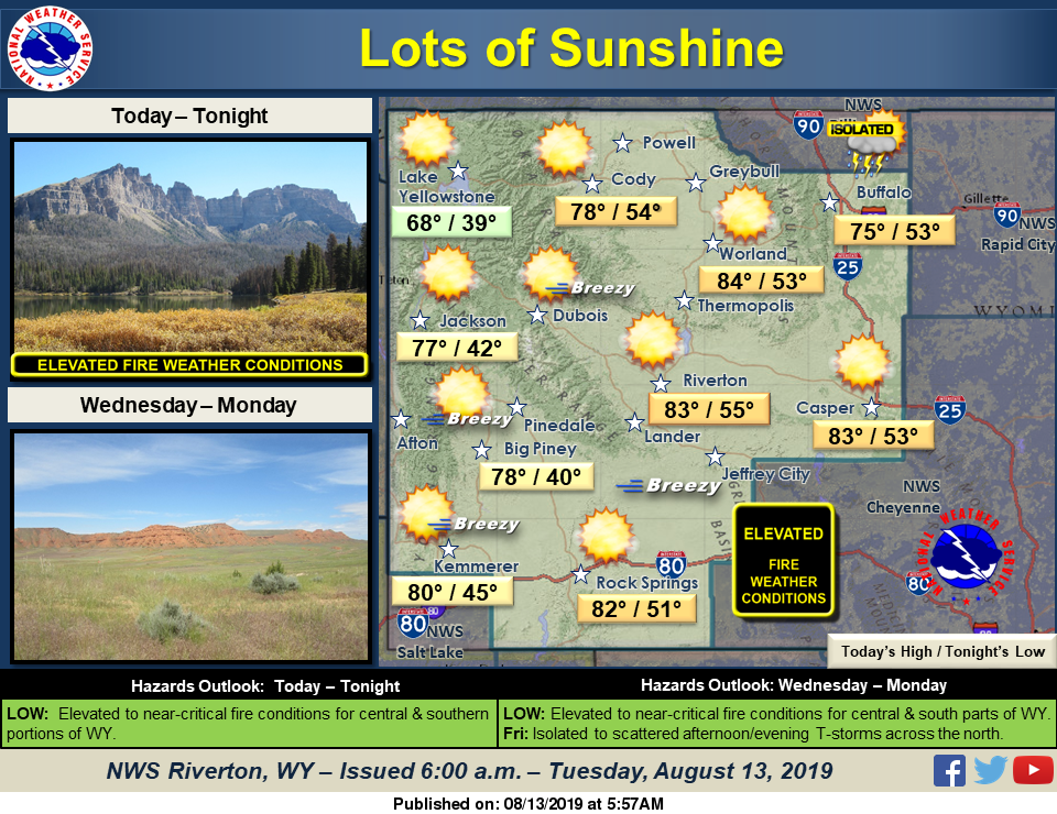
Dry westerly flow continues today keeping skies mostly sunny. However, isolated storms will develop across the north and some storms in Johnson County may become strong. Expect breezy winds this afternoon across the west and south, continuing the threat of elevated to critical wild fire conditions. Red Flag Warnings are in effect for parts of western and southern Wyoming.
Detailed Forecast
Today
Mostly clear, with a low around 51. Breezy, with a west northwest wind 15 to 20 mph decreasing to 5 to 10 mph in the evening. Winds could gust as high as 30 mph.
Tonight
Mostly clear, with a low around 51. West wind 6 to 11 mph.
Thursday
Sunny, with a high near 86. Breezy, with a west wind 5 to 10 mph increasing to 17 to 22 mph in the afternoon. Winds could gust as high as 33 mph.
Thursday Night
Mostly clear, with a low around 50. Breezy, with a west wind 13 to 18 mph becoming light and variable. Winds could gust as high as 28 mph.
Friday
Mostly sunny, with a high near 82. Breezy, with a south southwest wind 6 to 11 mph becoming west 17 to 22 mph in the afternoon. Winds could gust as high as 33 mph.
Friday Night
Mostly clear, with a low around 49. Breezy, with a west wind 17 to 22 mph becoming light west southwest after midnight. Winds could gust as high as 32 mph.
Saturday
Sunny, with a high near 82. Breezy, with a west wind 5 to 10 mph increasing to 16 to 21 mph in the afternoon. Winds could gust as high as 32 mph.
Saturday Night
Mostly clear, with a low around 50. Breezy.
Sunday
Sunny, with a high near 85.
Sunday Night
Partly cloudy, with a low around 51.
Monday
Sunny, with a high near 85.
Monday Night
Partly cloudy, with a low around 51.
Tuesday
Sunny, with a high near 86.
Advertisement - Story continues below...

