
Weather Story
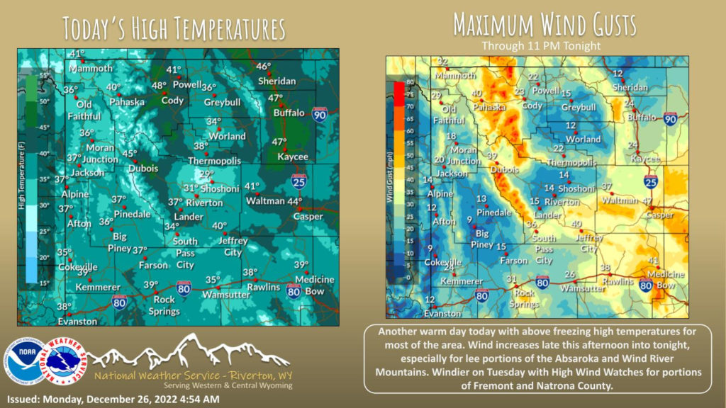
Warmer weather continues today. Wind increases for portions of the area this afternoon into tonight. It will stay dry for most, but snow moves into western Wyoming late tonight. High Wind Watches in effect for Tuesday in portions of Fremont and Natrona County.
– Detailed Forecast –
Today
Mostly cloudy, with a high near 38. West southwest wind 8 to 13 mph.
Tonight
Mostly cloudy, with a low around 25. South southwest wind around 8 mph.
Tuesday
A chance of snow between 10am and 4pm, then rain and snow likely. Increasing clouds, with a high near 38. East southeast wind 8 to 14 mph becoming south southwest in the afternoon. Winds could gust as high as 23 mph. Chance of precipitation is 60%. Little or no snow accumulation expected.
Tuesday Night
Rain and snow, becoming all snow after 10pm. Low around 28. South southwest wind 10 to 13 mph. Chance of precipitation is 80%. New snow accumulation of less than one inch possible.
Wednesday
A 30 percent chance of snow. Mostly cloudy, with a high near 34. Breezy, with a west wind 10 to 15 mph, with gusts as high as 21 mph.
Wednesday Night
A 20 percent chance of snow. Mostly cloudy, with a low around 15. Breezy, with a west wind 15 to 18 mph, with gusts as high as 23 mph
Thursday
Partly sunny, with a high near 27. West southwest wind around 14 mph, with gusts as high as 20 mph.
Thursday Night
Mostly cloudy, with a low around 12.
Friday
A 20 percent chance of snow. Partly sunny, with a high near 28.
Friday Night
A 20 percent chance of snow. Mostly cloudy, with a low around 17.
Saturday
A chance of snow. Mostly cloudy, with a high near 29. Breezy.
Saturday Night
A chance of snow. Mostly cloudy, with a low around 14.
New Year’s Day
A chance of snow. Mostly cloudy, with a high near 25.
Whatever the weather, have a wonderful day!
From all of us here at SweetwaterNOW

