
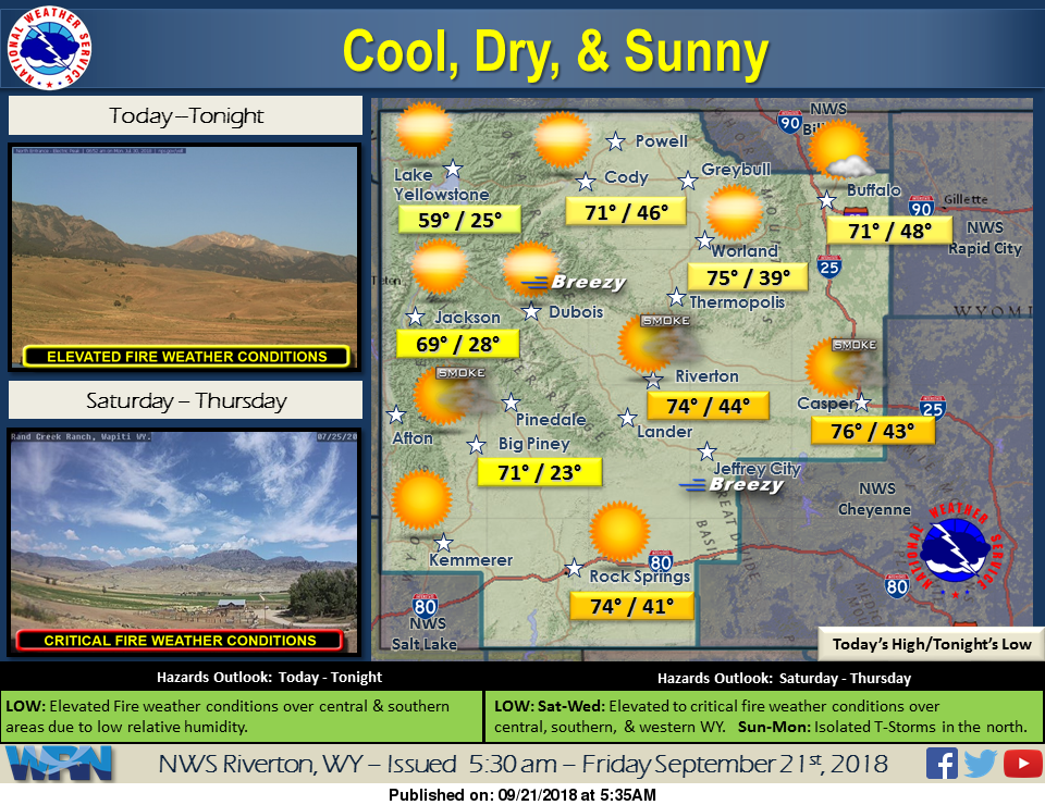
Slightly warmer today with dry and sunny conditions, thanks to a high pressure system moving across the region. It will be mainly calm except for some wind in the mountains, bringing our first none red flag day in a while. However, Saturday will be breezy and warmer and see the return of elevated fire weather danger.
Detailed Forecast
Today
Sunny, with a high near 73. Calm wind becoming west 5 to 9 mph in the afternoon.
Tonight
Clear, with a low around 39. West wind 5 to 9 mph becoming light and variable after midnight.
Saturday
Sunny, with a high near 78. Breezy, with a light south wind becoming west southwest 10 to 15 mph in the morning. Winds could gust as high as 23 mph.
Saturday Night
Mostly clear, with a low around 43. West southwest wind 6 to 14 mph becoming south after midnight. Winds could gust as high as 21 mph.
Sunday
Mostly sunny, with a high near 76. Breezy, with a south wind 8 to 13 mph becoming west 15 to 20 mph in the afternoon. Winds could gust as high as 30 mph.
Sunday Night
Mostly cloudy, with a low around 41. Breezy, with a west northwest wind 15 to 20 mph decreasing to 6 to 11 mph after midnight. Winds could gust as high as 30 mph.
Monday
Mostly sunny, with a high near 68. Breezy, with a west wind 9 to 17 mph, with gusts as high as 26 mph.
Monday Night
Mostly clear, with a low around 30. Blustery.
Tuesday
Sunny, with a high near 67.
Tuesday Night
Mostly clear, with a low around 36.
Wednesday
Sunny, with a high near 70. Breezy.
Wednesday Night
Mostly clear, with a low around 36. Breezy.
Thursday
Sunny, with a high near 73.
Advertisement - Story continues below...

