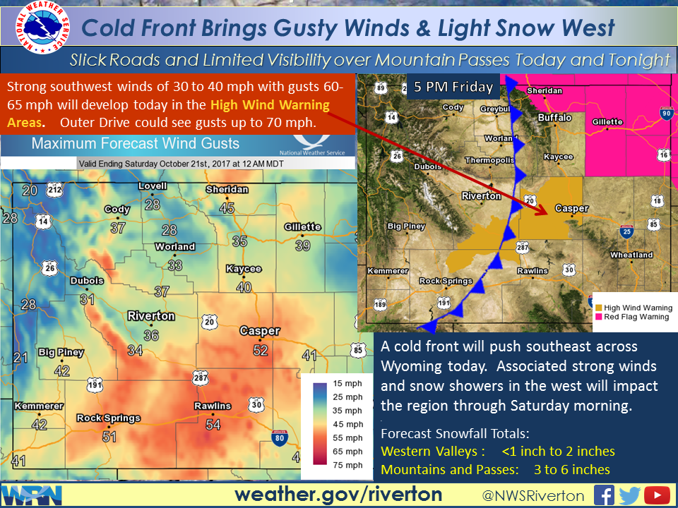

WYOMING — Gusty southwest winds will develop this morning, becoming strong by mid to late morning, across portions of southeast Fremont to Natrona County. Southwest winds of 30 to 40 mph with gusts of 60 to 65 mph are expected. Gusts up to 70 mph will be possible over Outer Drive on the south side of Casper. Gusty winds of 35 to 45 mph expected elsewhere east of the Divide, as well as in the mountains.
Accumulating snowfall in the western mountains this afternoon, accumulating in the valleys tonight. Winds could mix with the snow, impacting visibilities over the western passes.
Gusty southwest winds will develop this morning, becoming strong by mid to late morning, across portions of southeast Fremont to Natrona County. Southwest winds of 30 to 40 mph with gusts of 60 to 65 mph are expected. Gusts up to 70 mph will be possible over Outer Drive on the south side of Casper. Gusty winds of 35 to 45 mph expected elsewhere east of the Divide, as well as in the mountains.
Accumulating snowfall in the western mountains this afternoon, accumulating in the valleys tonight. Winds could mix with the snow, impacting visibilities over the western passes.
Saturday night and Sunday, strong winds possible in the Absaroka Mountains and Cody Foothills. Light to moderate snow possible in the northwestern mountains.
Sunday night and Monday, a strong ridge top winds Sunday night. Strong northwest winds possible Monday morning in the northern Bighorn Basin and northeast Johnson County.
On Wednesday expect windy, warm and dry conditions which may result in elevated fire weather conditions across the central and south.
Spotter are urged to report snowfall amounts and wind gusts over 45 mph.